How we hiked the Trans-Catalina Trail
Day 1 - Long Beach -> Avalon -> Black Jack
Total Mileage- 13.8
Trail Miles - 10.7
Time - 5 hours
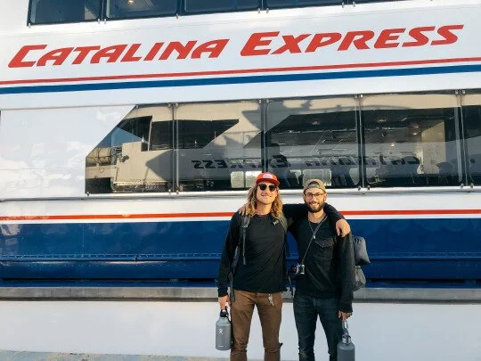
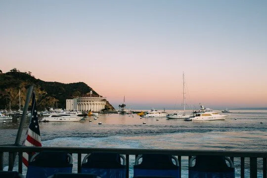
We took the 6AM Catalina Express ferry from the Long Beach port, which costs $34.50 per person. While researching online, we found that a new Trailhead center had recently opened, and that we would need to stop there to get our permits. We also read that we could arrange for firewood and water to be positioned for us at our first stop, the Black Jack campgrounds. The trails have a system wherein you are given a key to a lockbox, into which water and firewood can be placed so you don’t need to pack it in. In theory, very convenient. In practice, less convenient, at least in our case. We walked around Avalon for the better half of 90 minutes trying to find the person we needed to talk to to get this firewood and water. The woman working at the Conservancy told us we needed to call the Island Company. The locals told us we needed to go to the Conservancy. After a while of fruitless effort, we said “F*ck it” and started heading towards the head of the trail.
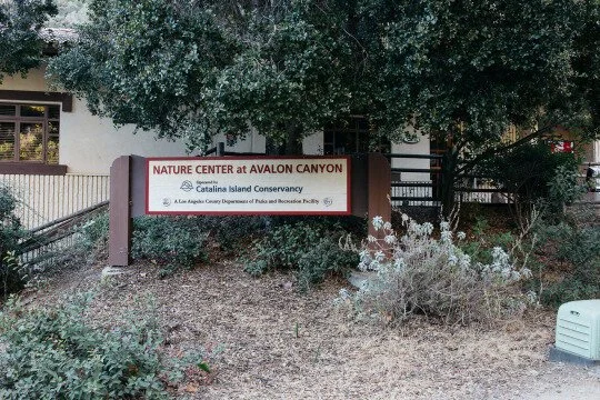
We walked past Catalina’s Nature Center around mile 2, and a very nice lady there told us there would be a place to refill our water 6 miles into our hike. She also told us there would be potable water at the Black Jack campground. As for firewood, due to high winds and dry conditions, there was currently a fire ban in effect, so a campfire of any kind was out of the question. Feeling reassured and confident, we continued on the first leg of our hike. In retrospect, we wasted time in Avalon for no reason. A bit of preparation and scouting of current conditions (maybe calling the Island Company ahead of time) would have saved us some effort.
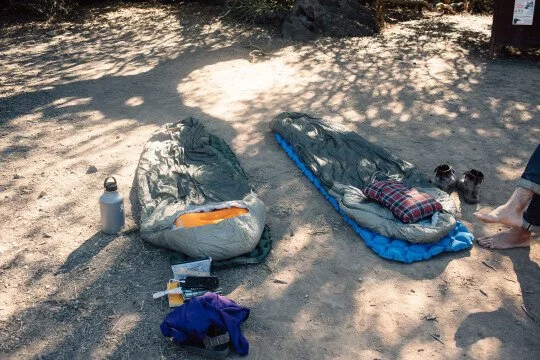
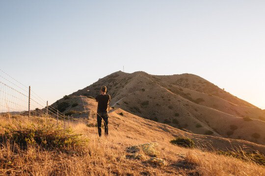
This first leg of the hike starts off on some switchbacks headed up the mountain, and then stays around 1,200’ for the remainder of the day. If you choose to hike the Trans-Catalina, you will be treated with some unique landscapes, awe-inspiring vistas, and will at some point enter the “playpen” through a large set of gates. Any time you are in this gated area, you are in bison country, and can encounter them roaming free. Obviously not a native species to the island, the bison were introduced in true California fashion: for a movie backdrop in the 1920s. The size of the herd is managed artificially (small islands aren’t meant for big hoofed mammals), and the gates simply control the range of the bison population. Make sure you stay at least 50 feet away from these animals! They are beautiful but can be dangerous. We left the 2 mile trail marker at 9:00AM, and hit Black Jack around 2:00PM, making for about 5 hours of hiking. There are multiple rest stop stations and places to fill up on water during this section of the hike. We settled in at Black Jack with our sleeping pads, pillows, and sleeping bags. We opted to really rough it and hike without tents, but were comfortable in our sleeping bags, even without a fire.
Day 2 - Black Jack -> Two Harbors
Total Mileage - 16.2
Trail Mileage - 13.5
Time- 7 hours
This was my favorite day of the trip, but also in my opinion the hardest. Some people choose to stop and spend the night in Little Harbor campground, which is about 9 miles from Black Jack. Little Harbor is a beautiful option on the exposed pacific side, with a clear sandy beach and lots of palm trees. We stopped here to eat lunch and check out the ocean, but know that if you choose to camp here you will need to be prepared for the wind coming off the sea.
This leg contained the most mileage traveled and the most diverse landscape of the entire trip. You start the day walking past the Airport in the Sky (mile 12.75), which is as the name suggests Catalina’s own airport. We personally decided to keep hiking, but I would highly recommend taking a load off and checking it out. They have amenities and a full restaurant, for both those staying grounded and those heading for the air. Their hours are seasonally variable like many of the places on the island– 8AM-7PM from April to October, and 8AM-5PM the rest of the year. After passing Airport in the Sky we continued to Little Harbor campground. We had a sip of coffee and a quick moment to relax, then pushed on towards towards Two Harbors. This was probably my favorite experience of the trip. The rawness on both sides, the way the cliffs dropped down to the ocean below, and the overcast conditions made it for a Lord of the Rings-like experience. I was my own Aragorn; I felt like we were transported to another universe for this section. We came back to Earth in Two Harbors, at a restaurant in town. The campsite itself is located about a quarter mile past the small village. There are fewer than 100 residents living permanently in Two Harbors, but they’re well-stocked for the hikers which pass through. You can check in at the information desk and get yourself situated. Don’t forget to hit the general store for a well deserved snack after a long day on the trail.
Day 3 - Two Harbors -> Parsons Landing
Total Mileage - 7.8
Trail Mileage - 6.6
Time - 4 hours
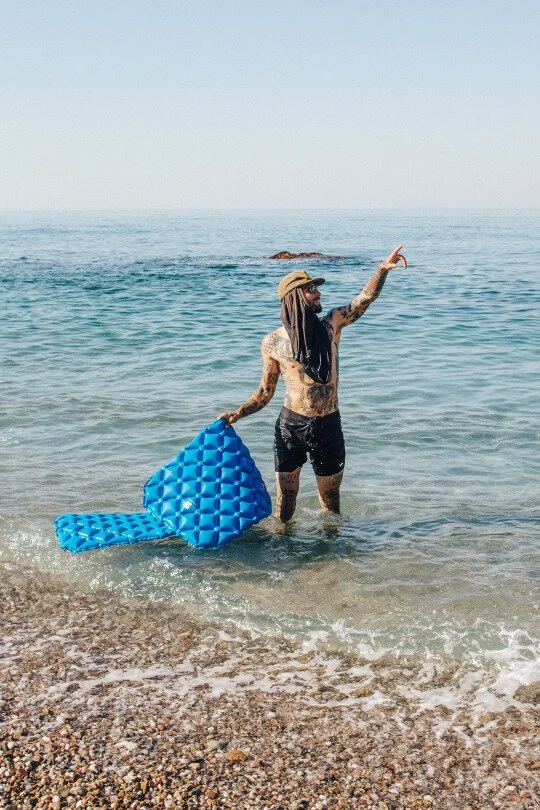
Day 3 will bring you to the highest elevation of the trip, 1,600’ above sea-level. It is an extremely steep ascent with an even steeper descent. You must check in at the information desk for this final chunk of the trek to get your firewood and water dropped at Parsons Landing, as there is no potable water or amenities to speak of. The trail kindly sends someone once a day to drop supplies for hikers, so you’ll be good as long as you stop at the information desk. On my way down from the peak, I was sliding on my pockets down what seemed like a giant gravel slide. We got into Parsons Landing around 12:30, and at that time of day the kelp flies were nearly unbearable. Not wanting to walk any more cliffs, we tried staying in the water to beat the bugs as best we could. The tide was a bit aggressive and there were a lot of sharp rocks in the water, which made it a tossup between being eaten by insects or smashed against the crags. When our water showed up around 3:00 PM, we decided to take our bets with the flies. Thankfully, they eventually went away at sundown and we could finally sit comfortably. We slept here for the night.

Day 4 - Parsons Landing -> Two Harbors
Total Mileage - 10.6
Trail Mileage - 7.7
Time - 3 hours
The last leg of the trip begins with a small trail that leads somewhat anticlimactically to a road. Follow that road at a gradual descent all the way back to Two Harbors, and there you have it, you’ve reached the end of the TCT. You wind past a few kids camps and some pleasant views on this final, leisurely day.
During the main hiking season, you can catch a ferry from Two Harbors back to San Pedro. Unfortunately, we were hiking during the off season. Again, this is where some forethought and planning will do you good. Having neither the time nor energy to hike all the way back to Avalon, we instead took the town taxi across the island. This cost us each an additional 94 dollars. Though we were both out some cash, it was funny to see the same scenery which took us four days of sweat to conquer, passing idly by the window of a taxi in just two hours. Feeling accomplished, exhausted, sweaty, and in dire need of a shower, we took the ferry from Avalon back to Long Beach.